Preparing filters, counts, and record results…
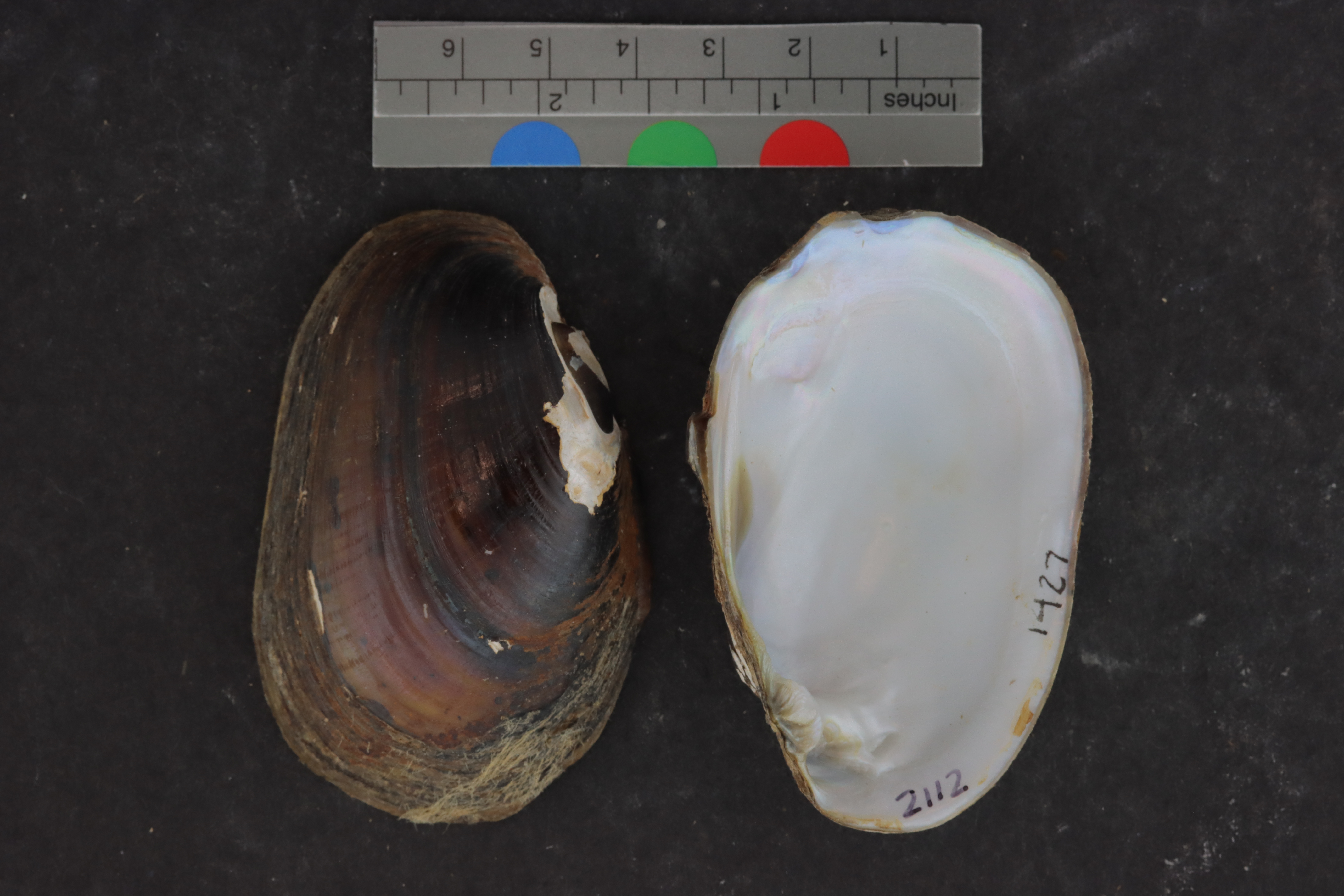
Lampsilis claibornensisALMNH:Inv:1427
rough fatmucket
Specimen Data
- Catalog #
- Inv:1427
- Common Name
- rough fatmucket
- Parts
- unknown (dry)
- Verbatim Date
- Between 15 June 2000 and 10 December 1997
- Remarks
- cryovial
Collecting Event
Date: Dec 10, 1997 – Jun 15, 2000
Collecting Agent(s)
| Name | Role |
|---|---|
| H. McCullagh | collector |
Identifiers
- Accession #
- 9999
| Type | Value | Assigned Date | Assigned By |
|---|---|---|---|
| identifier | 2110 | Apr 27, 2022 | unknown |
| identifier | 2111 | Apr 27, 2022 | unknown |
| identifier | 2111 | Apr 27, 2022 | unknown |
| identifier | 2112 | Apr 27, 2022 | unknown |
Media
Media 1 of 5
Location Map
Locality & Geography
Some fields below include values supplied by the locality normalization pipeline; they are marked (enriched).
Continent
North America
Country
United States
State / Province
Mississippi
County
Jackson County
Specific Locality
above Route 604 near Brewton Lake, 4 mi WSW of Wade
Verbatim Locality
Continent: North America; Primary Div: Mississippi; Secondary Div: Jackson; Water: Pascagoula; Basin: Pascagoula; Locality: above Rte 604 near Brewton Lake, 4 mi WSW of Wade
Coordinates
32.74165° N, 89.67870° WApproximate
Data Source
Approximate location — coordinates estimated from state centroid
Locality Pattern
Distance/direction reference — 6437 m WSW of Wade