Preparing filters, counts, and record results…
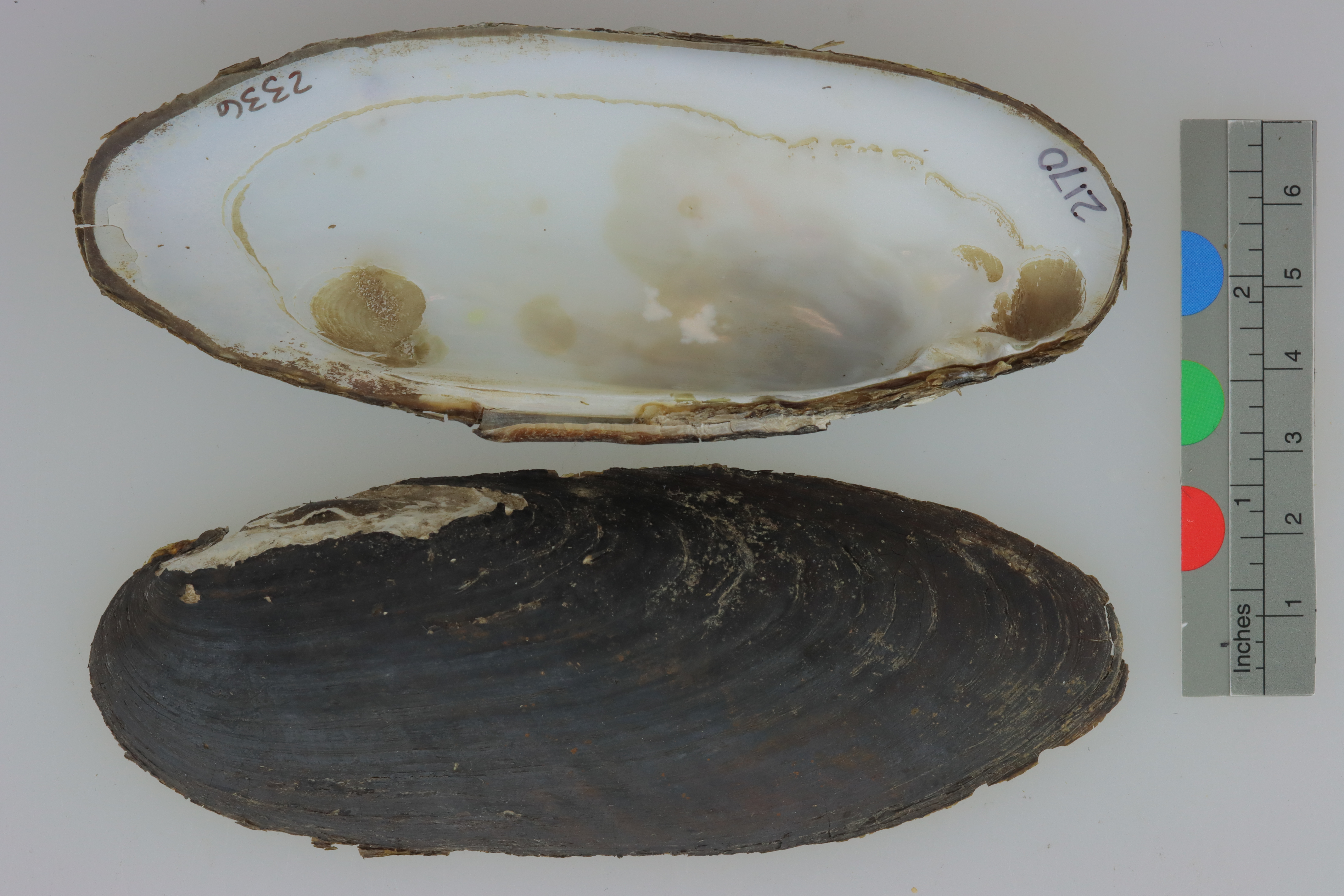
Ligumia rectaALMNH:Inv:2336
Black Sandshell
Specimen Data
- Catalog #
- Inv:2336
- Common Name
- Black Sandshell
- Parts
- unknown (dry)
- Verbatim Date
- Sep 26, 2003
Collecting Event
Date: Sep 26, 2003
Collecting Agent(s)
| Name | Role |
|---|---|
| Jennifer E. Buhay | collector |
Identifiers
- Accession #
- 9999
| Type | Value | Assigned Date | Assigned By |
|---|---|---|---|
| identifier | 2169 | Apr 27, 2022 | unknown |
| identifier | 2170 | Apr 27, 2022 | unknown |
Media
Media 1 of 3
Location Map
Locality & Geography
Some fields below include values supplied by the locality normalization pipeline; they are marked (enriched).
Continent
North America
Country
United States
State / Province
Kentucky
County
Rockcastle County
Specific Locality
1956 Crossing, 0.5 mi S of Billows
Verbatim Locality
Continent: North America; Primary Div: Kentucky; Secondary Div: Rockcastle ; Water: Rockcastle; Basin: Cumberland; Locality: 1956 Crossing, 1/2 mi S of Billows
Coordinates
37.36105° N, 84.31437° WApproximate
Data Source
Approximate location — coordinates estimated from county centroid