Preparing filters, counts, and record results…
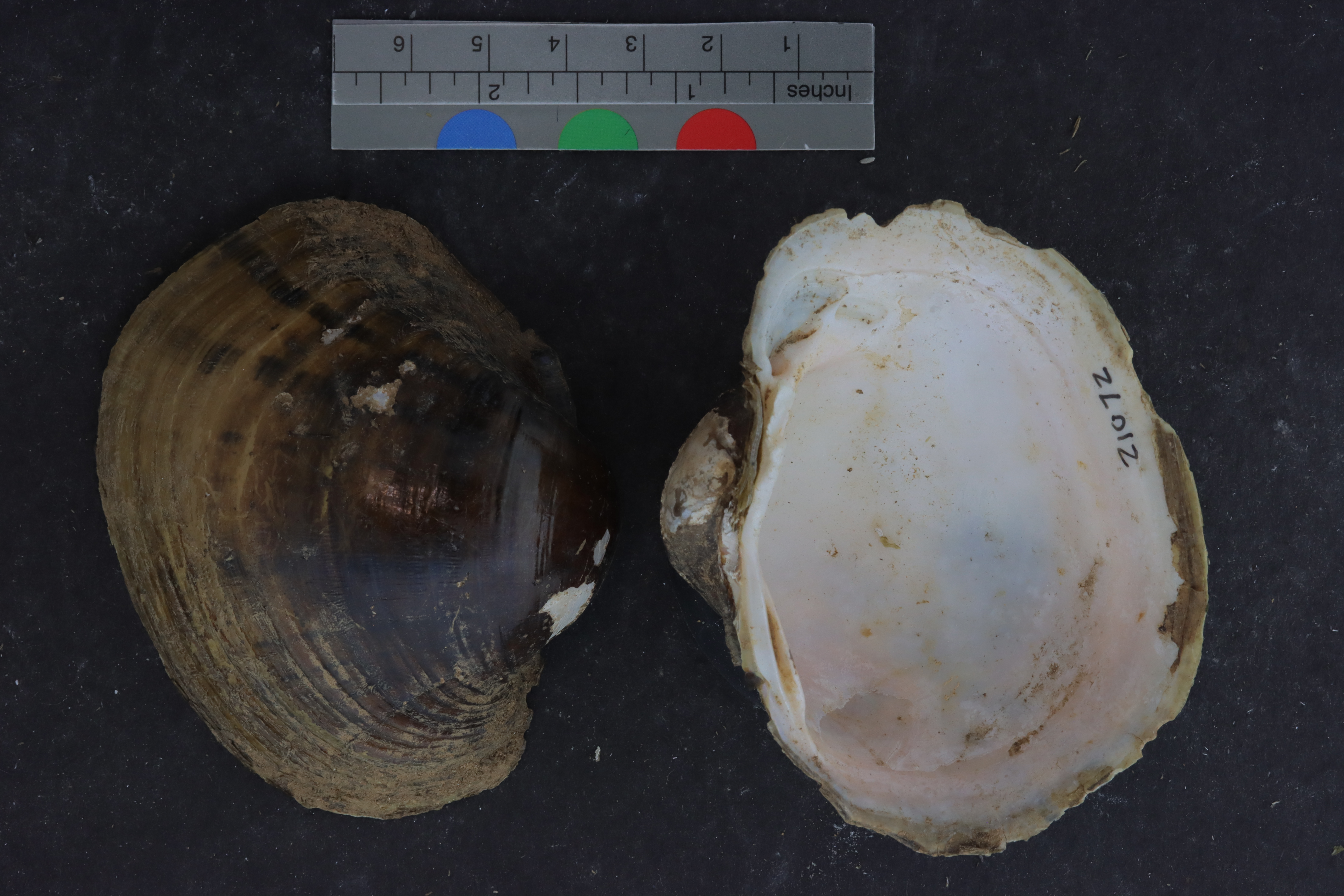
Lampsilis ornataALMNH:Inv:21072
Southern pocketbook
Specimen Data
- Catalog #
- Inv:21072
- Common Name
- Southern pocketbook
- Parts
- unknown (dry)
- Verbatim Date
- Aug 30, 2006
- Remarks
- found dead, shell only
Collecting Event
Date: Aug 30, 2006
Collecting Agent(s)
| Name | Role |
|---|---|
| unknown | collector |
Identifiers
- Accession #
- 9999
Media
Media 1 of 3
Location Map
Locality & Geography
Some fields below include values supplied by the locality normalization pipeline; they are marked (enriched).
Continent
North America
Country
United States
State / Province
Alabama
County
Greene County
Specific Locality
in sandy rock where river would have been if water level was up
Verbatim Locality
Continent: North America; Primary Div: Alabama; Secondary Div: Greene; Water: Sipsey; Basin: Mobile; Locality: in sandy rock where river would have been if water level was up
Coordinates
32.84450° N, 87.96420° WApproximate
Data Source
Approximate location — coordinates estimated from county centroid
Location Insights
Similar Records
Related records are suggested from shared taxonomy and geography so you can branch into nearby material quickly.